AboutSpatialHeatmaps
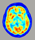 |
PET scan of the human brain
About Spatial Heatmaps |
|
Heatmaps use colors to measure levels or locations of activity. The heatmaps here are our attempt to represent the way Faulkner's imagination inhabits different parts of Yoknapatawpha in different texts and at different points in his career, according to the color scheme below. The "cooler" colors on the left (violet, blue) indicate the least activity; the "hotter" ones to the right (yellow, orange) indicate the most:  For example, the heatmap of "Mule in the Yard" (below) tells us that this short story takes place on the west side of Jefferson, and that the narrative's central site is on the edge of town near the railroad tracks – Mannie Hait's backyard, as you could learn by going to the story's DY homepage. To connect a specific heatmap with the identifiable Locations in that story, you have to visit that story's homepage. The map sequences viewable here are intended to allow you to look for patterns across the course of Faulkner's career.  The "temperature" of any particular spot on these heatmaps was determined by an algorithm that uses DY's Location and Event databases to add heat to a location for every event that takes place there. It has to be clearly noted that, unlike GPS routes, NOAA graphs or PET scans, our maps are approximations rather than precise measurements. In many cases the project's editors had to rely on their own scholarly judgment to decide where to locate a specific setting (as acknowledged in the "Authority" data field for each Location). But we stand by the essential story these maps provide, about the dynamic pattern of Faulkner's repeated returns to "Yoknapatawpha" and how the county's various areas claimed his imaginative attention at different moments in his career. While it's up to each reader to interpret what this pattern reveals about his evolving aesthetic and moral preoccupations, there are several variables worth considering. Such as: how the "southeast quadrant" as a setting typically may enable him to downplay issues like Southern history and racial relations. Or: what the relative distance from the center of Yoknapatawpha may signify; it does not seem coincidental that his two hardest looks at the sins of the old plantation aristocracy - Absalom! and Go Down, Moses - are centered in the corners of the county. Ten times Faulkner centered texts involving members of his cast of Yoknapatawphans outside the county entirely. The last of these was, curiously, his last book, The Reivers. Very little of that novel takes place in Yoknapatawpha, and as you can see on the map below, much of what does recounts the journey up the Valley Road and over the river that forms the county's northern border. Faulkner's occasions for displacing the main events in a fiction beyond Yoknapatawpha is another part of the pattern displayed by these heatmaps.  Our "quadrants" inside Yoknapatawpha are based on the symmetrical way Faulkner himself divides Yoknapatawpha on both his maps, with the road and railroad that runs north and south through the vertical center and the roads that run east and west on the horizontal axis. There are no maps for fictions centered in the southwest quarter of the county - because as far as we've been able to determine, almost no events take place in that part of the county. And most of them, according to our calculations, occur in one text, Light in August, as you can see below. The novel itself is vague about the route of Joe Christmas' flight after killing Joanna Burden; the textual evidence we found for locating it in the emptiest space on all the county maps is outlined in the Note on the Text for that novel. However, this is a good place to re-iterate the point that these maps are re-presentations of the fictions, and highly mediated ones at that. At the same time, the example of Light in August provides a Faulknerian - that is, ambiguous - way to end this note. Why might Faulkner have sent Christmas across that essentially un-charted terrain? How much can plotting Faulkner's art in this way help us to discover about the deeper logic of its ordered and disordered places?  Citing this resource:
|
- Log in to post comments